

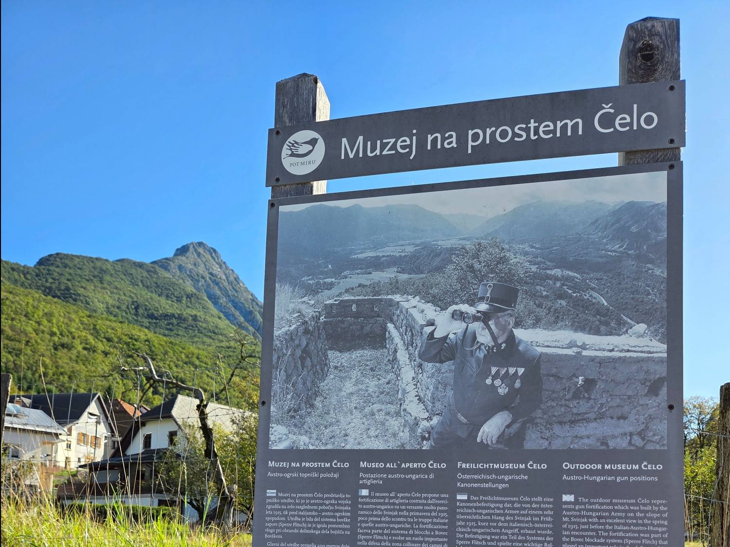
Muzej na prostem Čelo
| Region | Gorizia Statistical Region |
| Starting point | parkirišče v vasi Kal-Koritnica |
| Route length | 1 km |
| route duration | 1 h |
| Best time to visit | spomladi, jeseni |
| Appropriate for | Baby Carriers , 3-6 years of age , 6+ years of age |
| Level of difficulty | lahka pot |
Opis poti
Bovec z okolico nudi neizmeren vir športne zabave in odklopa. Kadar iščemo malce lažjo hribovsko pot, ki nas bo nagradila z izjemnimi razgledi potem bo pravilen odgovor izlet do muzeja na prostem Čelo.
Izhodišče je parkirišče v vasi Kal-Koritnica. Prečkamo cesto, tam pa nas že čaka prva informativna table z zanimivim opisom. Če smo pozorni pri ogledovanju, potem bomo opazili, da nas do Čela lahko pripeljeta dve poti. Mi smo sledili oznakam za hrib Svinjak.
Verjetno ima vsak svojo interpretacijo zakaj je Svinjak dobil tako zanimivo ime, še kakšna ideja pa se utrne ko ga gledamo pred seboj, saj daje eno najbolj prepoznavnih podob Bovški kotlini. Do našega cilja- muzeja na prostem Čelo bomo potrebovali 30 min hoje, vmes pa premagali nekje 220 metrov višinske razlike.
Kraj, kjer je utrdba, domačini imenujejo Na Čelu, med prvo svetovno vojno pa so ga avstro-ogrski vojaki poznali kot Stützpunkt Kal. Utrdba je bila del Bovške zapore (Sperre Flitsch), ki je služila obrambi pred morebitnim italijanskim prodorom. Ker do prodora ni prišlo, utrdba ni bila prizorišče neposrednih bojev.
Avstrijci so utrdbo začeli graditi novembra 1914, dokončali pa so jo tik pred vojno, spomladi leta 1915. Vanjo so vgradili dva 12-centimetrska topova M. 1880, ki so ju prenesli iz trdnjave Kluže. Utrdba je igrala pomembno vlogo pri obrambi dolinskega dela bojišča Bovške kotline. Iz nje je bilo možno obstreljevati cesto proti Klužam in prav tako cesto v Trento. Zaradi nenehnega obstreljevanja italijanskega topništva je bila na več mestih poškodovana. Zato jo je morala posadka zapustiti in položaje utrditi nekoliko nižje, pod spodnjim desnim delom utrdbe, kjer so zgradili veliko kaverno za oba zgoraj omenjena topova. Topova sta v zgodovino bojev v Bovški kotlini zapisana kot Baterija Kal
(zgodovinski opis vzet iz strani The walk of peace)
Interesting Facts
In summer, Slovenians like to visit the gorgeous Soča River. Get to know this emerald beauty a little better and read a few interesting facts.
1. SOČA RIVER SOURCE: The Emerald Soča is formed by water that accumulates in the area of Jalovec, Šite, Travnik and Mojstrovka springs from a cave with a small subterranean lake and flows through a narrow gorge, which soon opens up. (Source: soca-valley.com)
2. OLD NAMES: The upper part of the Soča is also known by the old name of Šnita. The river was recorded in antiquity as Aesontius, Sontius, and Isontius. The Slovene name Soča is derived from the form *Sǫťa, which was borrowed from Latin (and Romance) Sontius. In turn, this is probably based on the substrate name *Aisontia, presumably derived from the PIE root *Hei̯s- 'swift, rushing', referring to a quickly moving river. (Source: en.wikipedia.org website)
3. TRIBUTARIES: Soča has many beautiful tributaries. Its main ones are Koritnica, Tolminka, Idrijca and Vipava in Slovenia; and Torre in Italy.
4. SOČA RIVER TEMPERATURES: Only the brave or those who wear wetsuits can bathe in the Soča River. In the years 2004–2010, it had an average temperature of 10.5 ° C (50.9 °F) in the bathing season. The highest recorded temperature ever was 13.8 ° C (56.8 °F), in Tolmin 12.0 ° C/ 53.6 °F (highest 15.1 ° C/59.1 °F), in Kanal 15.3 ° C/59.5 °F (highest 21.3 ° C/70.3 °F) and in Solkan 14.3 ° C/57.7 °F (highest 18.8 ° C/65.84 °F). Low water temperatures are mainly due to the supply of the river from many karst springs in the entire course up to the town of Solkan.
5. WAR: Between 1915 and 1917, the Soča/Isonzo Front ran through the Soča Valley and the surrounding mountains above it, claiming more than 300,000 lives of Italian and Austro-Hungarian soldiers.
6. SOČA RIVER AS AN INSPIRATION: Soča inspired the Slovenian poet Simon Gregorčič to dedicate his most famous patriotic poem titled To the Soča River. Here is the first stanza:
You are splendid, limpid daughter of the heights,
You are graceful in your natural beauty,
When your transparent depths
Are not disturbed by the
Wrath of darksome storms,
You are splendid, limpid daughter of the heights!
7. TROUGHS: The deep and narrow troughs carved into the lively valley are a special feature of the Soča River. They appeared due to a certain change in the environment (e.g. glacial retreat, tectonic movement, etc.). The most beautiful are the Mala korita Troughs just before the mouth of the Vrsnik Stream and the Velika korita Troughs before the mouth of Lepenjica Stream. The Soča Troughs (Korita Soče pri Kršovcu) are just as amazing to look at.
8. A SPORTS PARADISE: The upper course of the Soča RIver is ideal for kayakers, canoeists, rafters, canyoning… The surrounding peaks are ideal for hikers and mountain bikers. From the Soča Valley, many mountain trails lead to the surrounding 2,000-meter (6,561 feet) peaks (Kriške pode, Triglav, Bavški Grintavec, Kanin, Krn, Rombon ...) and other mountaintops: Svinjak, Kobariški Stol, Matajur ... You can walk the 20-kilometre (12-mile) long Soča Trail which starts at the Soča River Source.
9. WATERFALLS: Numerous beautiful waterfalls grace the Soča River surroundings, namely Kozjak Waterfall, Virje Waterfall, Kaludrica Stream, Fratarica Stream, Predarica Stream with waterfalls, Globoški Stream with waterfalls, Zapotoški Waterfalls, Šunikov vodni gaj Nature Reserve, etc. Let us not forget the Boka Waterfall, located near the town of Bovec, which is the the most powerful Slovenian waterfall with a total height of 144 m (472 feet) and a width of 18 m (59 feet).
10. HYDROELECTRIC POWER PLANTS ON THE SOČA RIVER: Soča River has seven large dams, with four of them in Italy and three of them as hydroelectric power plants in Slovenia. The website of SENG (Soške elektrarne Nova Gorica/Soča hydroelectronic power plant Nova Gorica) states that their long-term plan is to build dams on the upper Soča and Učja rivers, which would mean the destruction of our great pearl. Fortunately, individuals and movements like the Balkan Rivers Defense are committed to preserving our beautiful emerald.
Map
Download GPX
muzej na prostem Čelo| Start point coordinates | 46,3359232 |
| 13,5821528 |
| Start point coordinates | 46,3359232 |
| 13,5821528 |
Take me to the starting point
Show route in Google mapsRent a car


Nearby Restaurants
Farm Jelinčič & Camp Jelinc
This is the ideal starting point for the hikes around Soča River, exploring the Bovec area and nearby mountains, as well as for many sports activities. The staff makes sure your stomach is full and satisfied. Your dogs are welcome here and the camp even has cats!
Their special dish is trout with cheese. So yummy! ;)
Soča 50,
5232 Soča
05 388 95 10
051 222 735

Mila and Staš Recommend
If you look up, you will surely notice paragliders high in the air. The planes from Bovec Airport fly them to the take-off points. You can visit the airport and observe all take-offs and landings while sipping on some juice. When I grow up, I will be a pilot!
.jpg)
.jpg)
.jpg)
.jpg)
.jpg)
.jpg)
.jpg)
.jpg)
.jpg)


